Australia and the Southeast Indian Ocean are the latest regions to join a vital global shark and ray database that maps critical habitats for vulnerable marine life. This expansion has delineated 158 new Important Shark and Ray Areas (ISRAs) across the region, marking a major step forward in worldwide marine conservation efforts.
The ISRA project is a global collaboration led by the International Union for Conservation of Nature (IUCN) Species Survival Commission Shark Specialist Group (SSG). The primary goal is to identify key habitats that have the potential to be managed for conservation. This mapping is critical, as the SSG estimates that more than one-third of all sharks, rays, and chimaeras are currently threatened with extinction.
Reversing Decades of Population Decline
Shark and ray populations have struggled globally, primarily due to overfishing and other human impacts. A 2021 study revealed that the global abundance of 31 oceanic sharks and rays plummeted by more than 70 percent since 1970.
Until recently, these marine animals were not always a primary conservation focus. However, Rima Jabado, chair of the IUCN Shark Specialist Group, notes that the narrative is shifting. The ISRA initiative, launched in 2021, identifies areas based on critical life activities such as reproduction, feeding, aggregation, and migration.
While Charles Darwin University reports that the recent Australian additions bring the worldwide total to approximately 1,000 ISRAs, a recent IUCN report titled “Ocean Travellers” specifically delineates 816 areas across the nine ocean regions completed so far. Research on the remaining four ocean regions is expected to be released later this year.
Despite the large number of areas identified, Jabado states that the ISRAs cover less than 3 percent of the ocean’s surface within the nine completed regions. This relatively small footprint suggests that targeted conservation of these species is highly achievable. The ISRAs vary significantly in size and shape. For instance, the Maldives hosts 27 small ISRAs, while a single ISRA designated for vulnerable bigeye thresher sharks south of Hawaii covers an area roughly the size of Colombia.
Australia’s Role in Marine Conservation
The global database relies on the work of more than 1,400 contributors. In Australia, significant data came from the Northern Shark and Ray Research Group (NSRRG) at Charles Darwin University (CDU). The group helped outline ISRAs across the Northern Territory, Queensland, Western Australia, and New South Wales.
Dr. Peter Kyne, a CDU Adjunct Senior Research Fellow who established the NSRRG, has been involved with the ISRA project since it began. He emphasizes that the scientific, evidence-based data can directly assist policy and decision-makers in designating marine protected areas. Spatial management is highly effective for conserving marine and freshwater environments amid global species declines.
Through CDU’s 18 years of research, nine specific ISRAs were identified in the Northern Territory alone. These areas span numerous river systems, estuaries, and offshore oceanic habitats. Dr. Kyne points out that the Northern Territory currently has very limited marine park coverage, making the new data a vital tool for future conservation planning.
A Global Refuge for Threatened Species
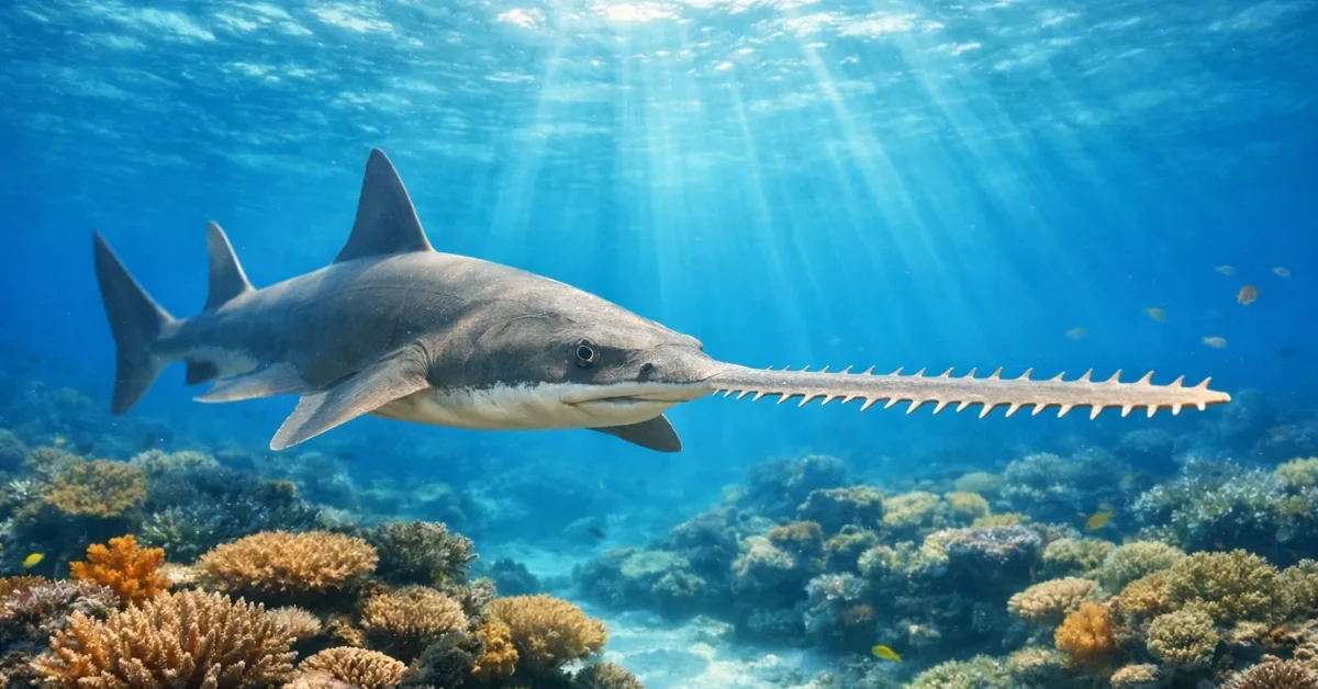
Australia is increasingly recognized as a vital sanctuary for highly vulnerable marine life. Dr. Joni Pini-Fitzsimmons, leader of the NSRRG, highlights that the region is one of the last global strongholds for species like threatened sawfish and river sharks. Sawfish populations have experienced severe declines worldwide, leaving northern Australia as a crucial refuge.
The Australian contribution also stands out for its integration of Indigenous knowledge. Dr. Pini-Fitzsimmons notes that long-running collaborations with First Nations groups, such as the Malak Malak Rangers on the Daly River, played a key role in the project. The Northern Territory ISRAs feature a high amount of incorporated Indigenous knowledge, showcasing these local insights to a global audience.
Turning Data into Protective Policy
It is important to note that designating an area as an ISRA does not automatically provide legal protection. Instead, these areas serve as a policy tool to encourage governments and regional bodies to implement strict conservation measures.
Currently, very few ISRAs overlap with strictly protected marine areas. For example, in the Western Indian Ocean, only 1.2 percent of ISRAs overlap with “no-take” zones where fishing is entirely prohibited.
The push to map these critical habitats aligns with broader international conservation goals. The IUCN released its most recent in-depth report ahead of a major March meeting in Brazil for parties to the Convention on the Conservation of Migratory Species (CMS). Area-based management decisions for marine species are a key agenda item at the United Nations treaty meeting.
By providing clear, evidence-based maps of where sharks and rays most need protection, researchers hope governments will prioritize these areas to ensure vulnerable marine species do not go extinct.
